
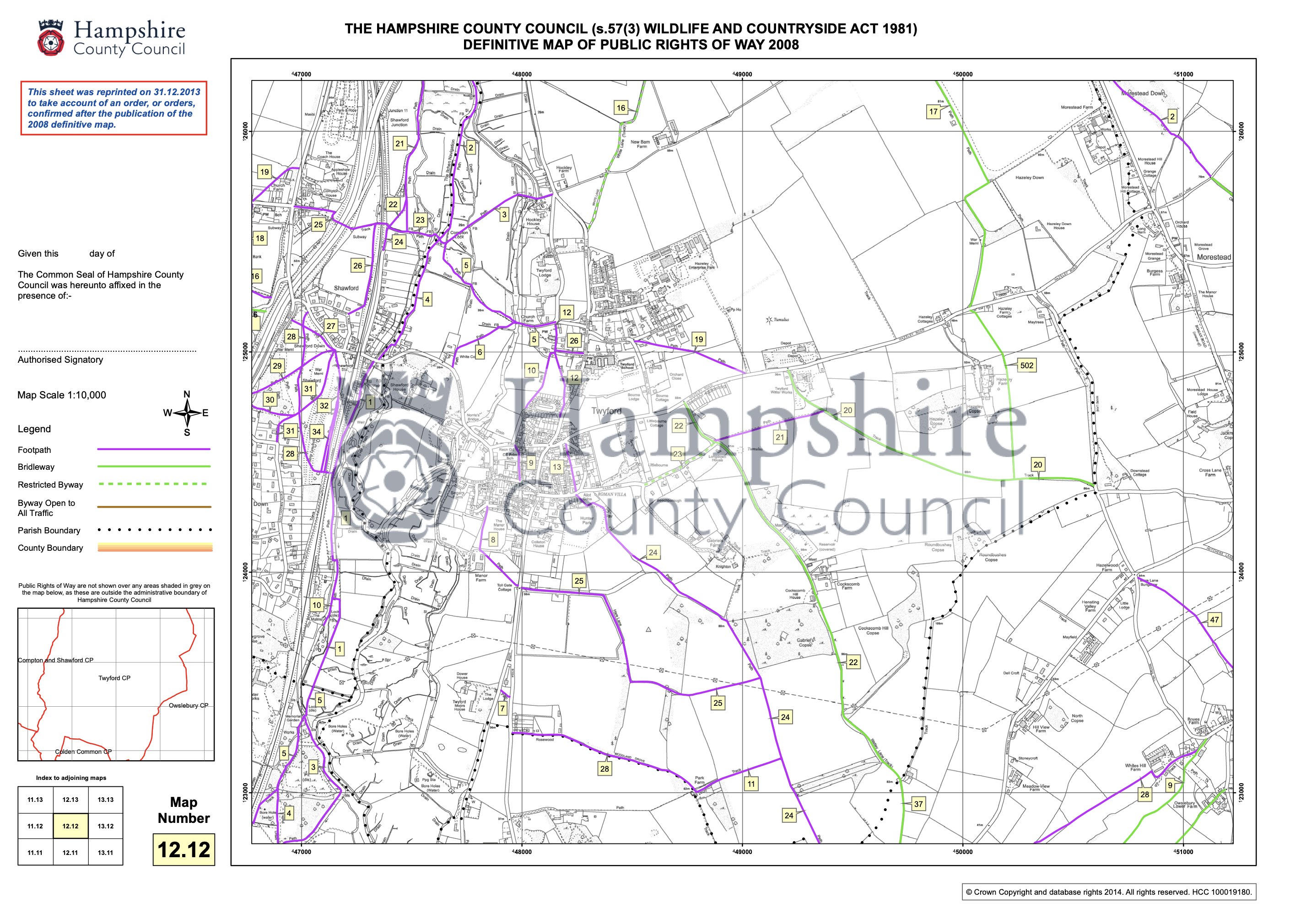
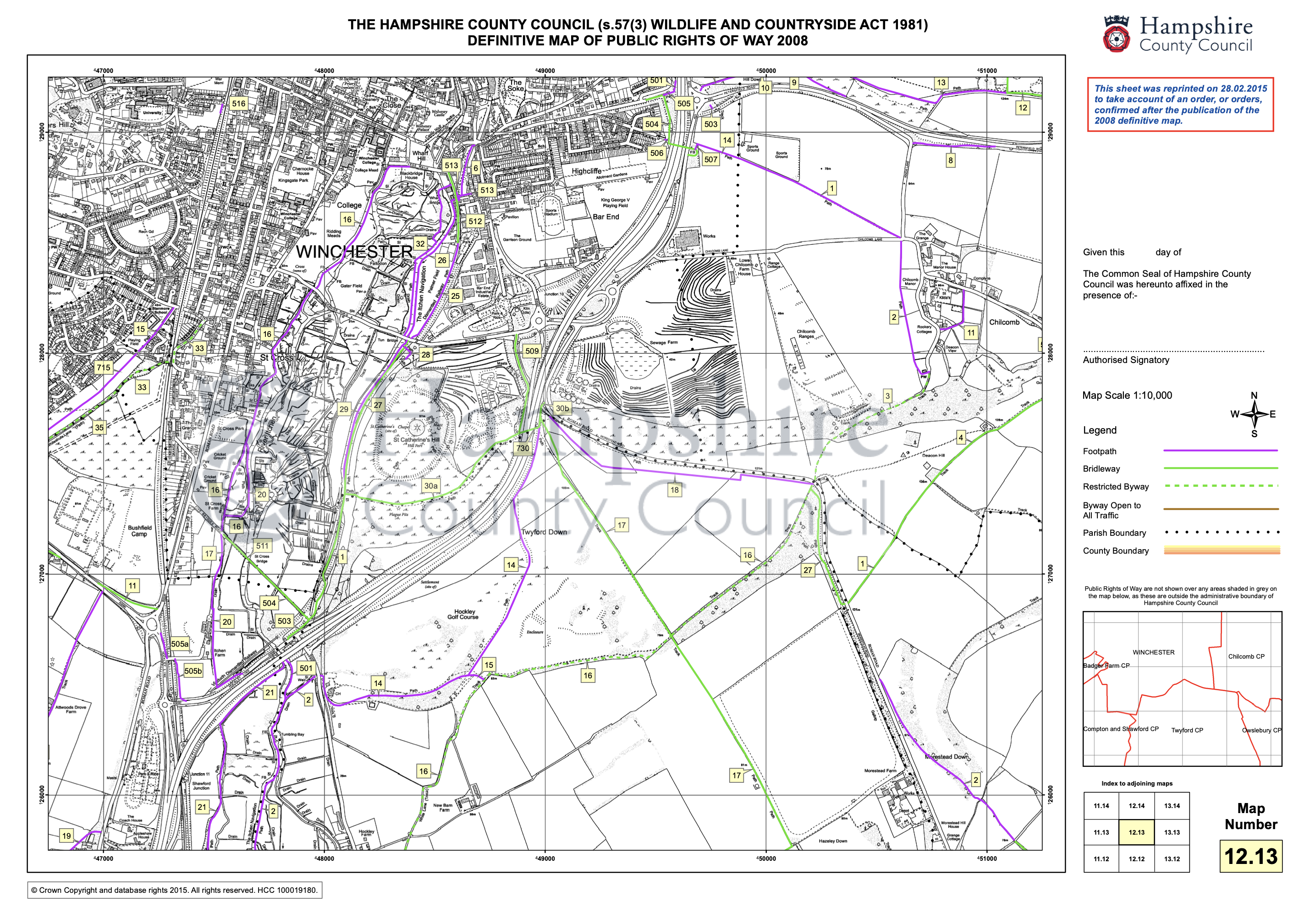
A map of all public rights of way in Twyford Parish, which is itself on the western edge of the South Downs National Park, can be found by using the following link to the Hampshire County Council webpage: Hampshire Definitive Rights of Way map
The Hampshire County Council website enables users to identify footpaths, bridleways and other public rights of way throughout Hampshire. It also provides a detailed description of each established right of way.
The following two images show extracts from the Hampshire Definitive Rights of Way map. Clicking on an image will open a larger version of the extract on a new page.
Application to amend the ‘Definitive Map’ of public rights of way
Twyford Parish Council is seeking to make an application to Hampshire County Council to amend the ‘Definitive Map’ of public rights of way, to add a Bridleway. In order to establish that the track, from the Main Road B3335, opposite Hockley Cottages passing New Barn Farmhouse to White Lane is a recorded public right of way the Parish Council, as co-ordinator, must submit an application under the provisions of the Wildlife & Countryside Act 1981. This would include ‘User Evidence forms‘ and signed map completed by as many individuals as possible who have used that route.
The Parish Council will also be required to notify and serve a notice on the Landowner (s) as part of their application procedure.
For information, please follow the link : https://www.hants.gov.uk/landplanningandenvironment/rightsofway/definitivemap
In 2005, some steps were taken to amend the definitive map. It has been established that 10 ‘user evidence forms’ were completed and submitted, but due to a technicality, it has come to light that the application was incomplete and was never progressed. Even if you recall completing a form in the past, please would you now complete the following form and sign and date the following map.
User Evidence Form: User Evidence Form (DMMO)_(HF000006102744)
If you have used the track opposite Hockley Cottages passing New Barn Farmhouse to White Lane as a footpath or bridleway, or you know other people who have, please complete the above user evidence form (or encourage the other users to do so). Please provide as much supporting information and evidence as possible; and then return the form with the signed and dated map to:
The Twyford Parish Clerk, PO Box 741, Winchester, SO23 3QA
Any persons completing the ‘user evidence form‘ needs to be clear whether they have ever seen any notices at the ends of the track and confirm the wording. Although a sign is now in place; please state whether there were any other signs visible during the period that you state you used the route, and if possible please refer to when they were in place and their wording, or confirm the period during which there was no visible signage.
Hampshire County Council’s website, is accessible via the above link, and provides guidance but if any person contemplating completing a user evidence form needs any guidance then please email clerk@twyfordhants.org.uk or telephone 07443 598464.